If you haven't already seen sister Jan's description of our childhood home, do so before you look through this page.
So what became of Jan's Paradise when Mount Saint Helens blew her top on May 18, 1980? The river that had peacefully started its way to the Pacific from Spirit Lake ceased to exist as we knew it. Within seconds, it was replaced by a wall of mud roaring down the river valley, taking with it anything that got in its way.
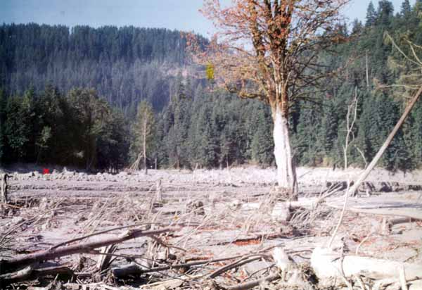
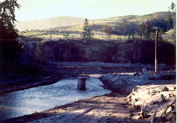
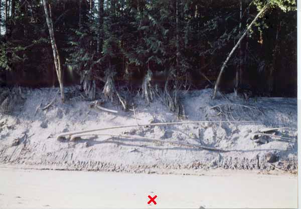
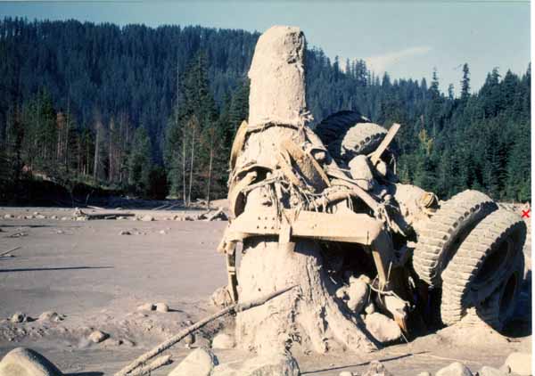
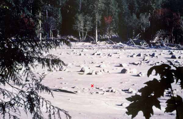
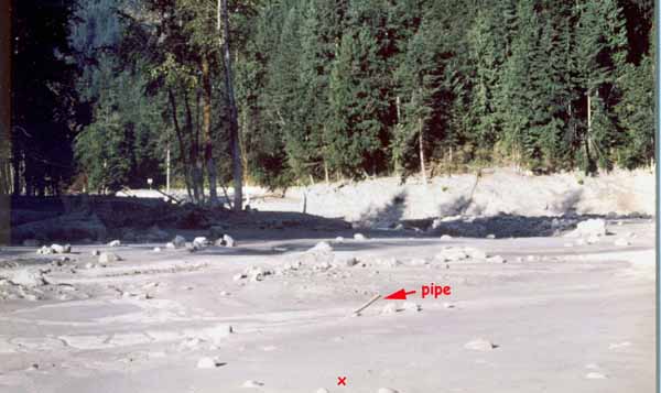
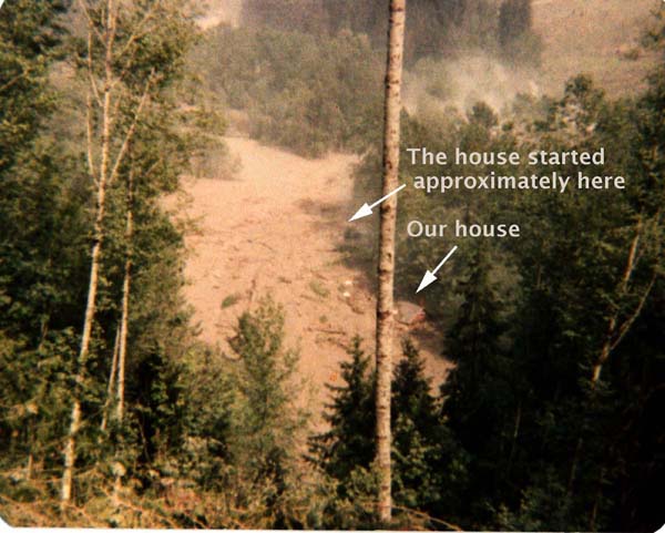
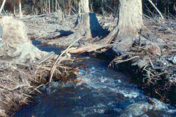
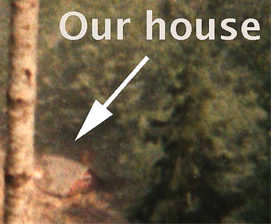
Trees, logging trucks, bridges, boulders...even people...were swept down the 40-mile length of the Toutle to Castle Rock where the Toutle entered the Cowlitz River. Within minutes of the eruption, the flow had traveled 20 miles west where it hit our beloved "502," first knocking out the Weyerhaeuser railroad bridge upstream from our house, leaving only one concrete pier as a silent reminder of what had been. The red "x" marks the pre-mudflow location of our house. Part of a logging truck wrapped around the jagged stump of a tree near the bridge was a reminder that Weyerhaeuser's Camp Baker had been a few miles further upstream.
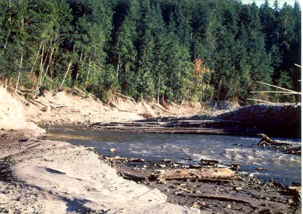
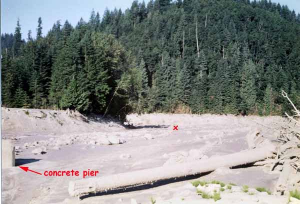
After taking out the bridge, the flow wasted no time picking up our childhood home, which bravely held together for the first moments of its journey. Seconds later, it wiped out the beach, reducing the "calm, sandy spot on the river and the fern-, moss-, and wildflower-adorned basalt cliff" to an ugly scar. The moving wall then destroyed the county bridge that marked the western end of our property, and shortly thereafter, a second Weyerhaeuser railroad bridge, again leaving a single pier intact.
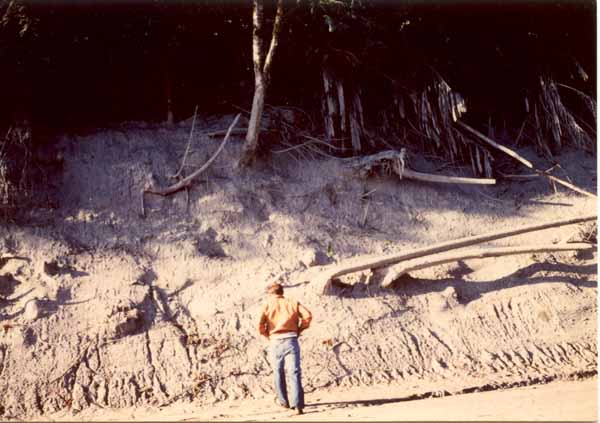
I was the first human to walk on the riverside property that had been our home. How do I know? For one, a State Patrol roadblock at Kid Valley, two miles downstream from "502," had prevented entry, even on foot, into the expanded "Red Zone." My impassioned plea fell on deaf ears. But I had the advantage of knowing the territory. Backtracking down the Spirit Lake Highway until I was out of sight of the roadblock, I parked and waded the river, now a faint shadow of its pre-eruption self. Paralleling the river but on the opposite side from the roadblock, upstream from which a caterpillar struggled to replace the highway, I followed the grade of the Weyerhaeuser railroad that skirted "502," amazed that every rail and every tie had disappeared. But the fact that I had to violate the Red Zone to get to our home site was not the only thing that convinced me I was the first human into the area. Everything near the river was covered with a soft layer of dried mud, and every step I took left a very prominent print. I saw no other human footprints during my entire time in the area. Oddly, I thought, there were also no animal tracks in the dried mud...where had the timid doe gone?
As I looked across the trickle at our property, I should have see the "grove of cotton wood on a sandy river flat, a grotto overflowing with sword fern, bracken fern, and maidenhair fern, or a gray, ovoid, water-washed river rock." Instead, I was greeted by a flat, caked-mud surface, littered with rounded, rough boulders, and devoid of any living thing. Also absent was any sign of prior human habitation, save for a two-inch pipe sticking out of the ground a few feet west of where the house had been. The thought that it might have been from our well crossed my mind, but quickly vanished...could it have moved about 100 feet while remaining upright? The pipe probably came down the river...perhaps from Camp Baker...and just happened to get stuck where it did.
I stood precisely where our house had been, studying a small hill that had bordered our property to the south. Remembering the many times I had slid down its steep slope as a child, I tried to judge whether I was standing below the original level of the house foundation...had the mudflow gouged a deep trough as it rolled through. Or was I standing above the old level...had the mudflow left a deposit. I concluded that I was actually standing at the SAME level, give or take a few inches. I placed my camera on a rock, set the timer, and walked to the base of the hill to place myself in the photo for reference. The camera caught me as I neared the hill, standing where a paved county road had been. Was the pavement still there below a few inches of mud? I didn't check.
Looking due east into the morning sun and directly up the river valley, revealed no recognizable feature. And looking back from the hill toward where the house had been, I was reminded of a moonscape.
The foundation of our home had been perhaps ten feet vertically from the normal river level. From the looks of the scars on the small hill, the wall of mud had been at least another fifteen feet high. On the opposite side of the river, which would have been on the outside of a curve where the flow changed directions by almost 180 degrees, the flow was even higher, perhaps 30-40 feet as witnessed by the mud stains on the remains of a large maple tree.
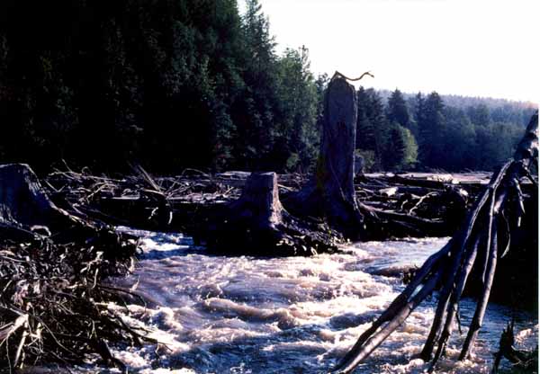
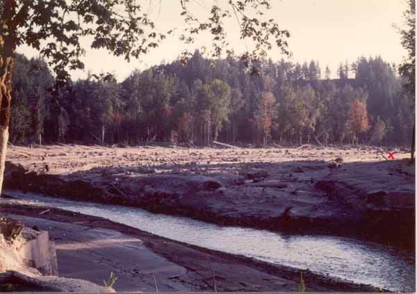
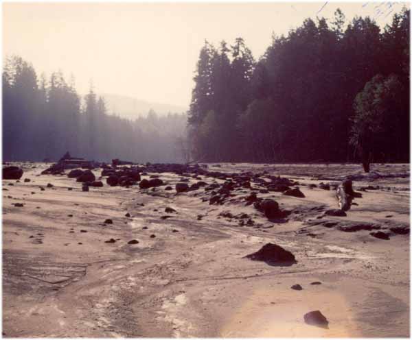
The confluence of the Toutle and Green Rivers, which had been the premier salmon, harvest trout, and steelhead hole on the river (the second photo on Jan's "Paradise" page shows the two rivers joining during high waters in the spring) was now a jagged scratch in the landscape. I jumped across each stream in one bound, just so I could say I had done so. The joined streams seemed to disappear to the west under the sturdy stumps of trees that had been snapped off by the initial mudflow.
Update!
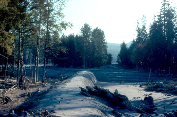
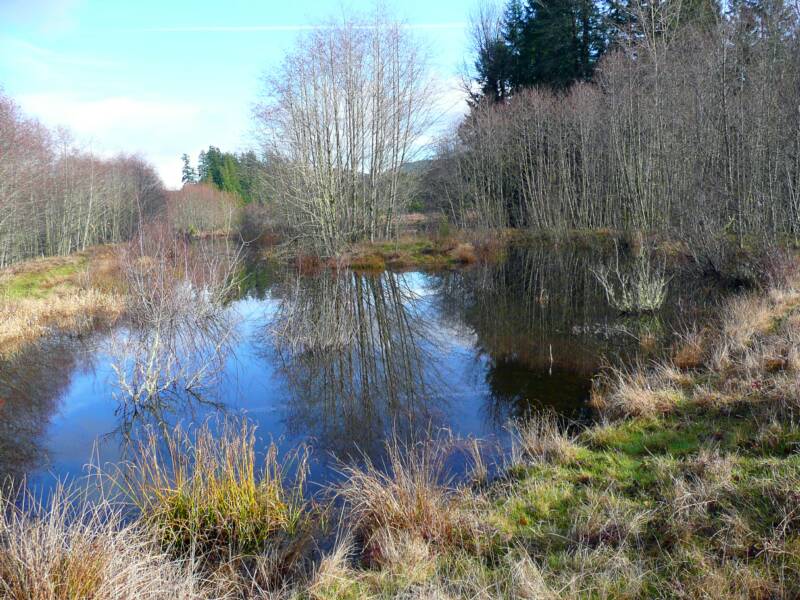
In the first 27+ years after the devastating mud flow, "502" HAS recovered...with a little assistance from mankind. The area was back- filled with silty soil from the river channel. ponds were built, and the acreage planted with natural grasses and shrubs. "502" is now a bird sanctuary, a fitting use in the minds of the Brake family since it hopefully means nobody will again inhabit "our" little piece of paradise.
The 2007 photo to the right is looking toward the wooded hill (to the right) where I am shown in one of the photos above, and the red "x" again shows where the house had stood in early 1980.
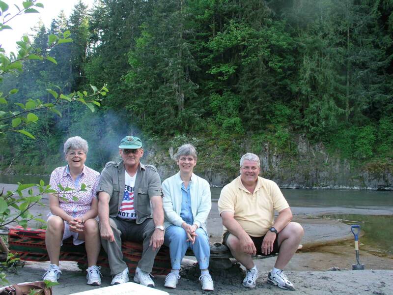
And once again, the beach is there for us (Jan, me, Sal, and Jack below) and our families and friends to enjoy!